Welcome to our website on our plans for approximately 800 new high-quality market and affordable homes at a strategic site to the north of Telford.
Our proposals include a mix of houses to give real choice for current and future residents at every stage of life, including smaller starter homes, larger family homes and adaptable homes.
The plans also include:
- A Local Centre with a range of community amenities and a Mobility Hub
- Land for a new primary school and nursery
- Community open space, including allotments, community gardens and sports pitches
- A range of Active Travel and connectivity features with green cycleways and footpaths
- Extensive green infrastructure and significant biodiversity enhancements
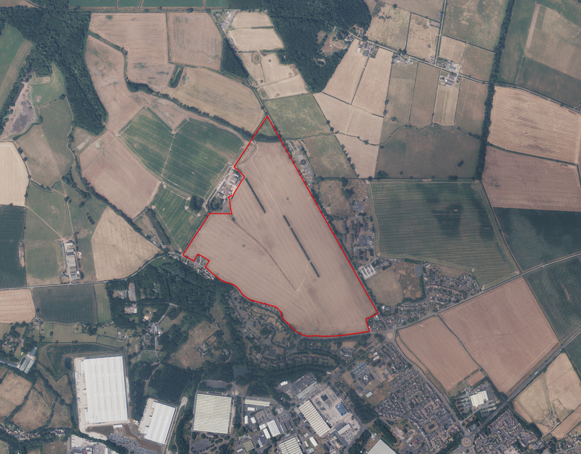
The site
The 50ha site lies on the north eastern edge of Telford and comprises a large, roughly triangular field bordered to the south by residential properties and Humber Lane. The site’s eastern boundary is formed by Donnington Drive, beyond which are residential properties, Parsons Barracks, a small private sewage treatment works and fields. The site is bordered to the west by Lubstree Park private road and Lubstree Park farmhouse and associated farm buildings, beyond which are more fields.
Telford & Wrekin’s Local Plan Review
The plans for our site form part of Telford & Wrekin Council’s proposals for a new Sustainable Community at land North East of Muxton, which will deliver 2,700 new homes and associated infrastructure.
.jpg)
Telford & Wrekin’s Local Plan - Land North East of Muxton
This Sustainable Community, one of three to the north of Telford, is a key part of the Council’s Local Plan Review. It will significantly contribute towards meeting the future housing and employment needs of the area in the period to 2041 and beyond.
We are working closely with the Council and other developers to ensure that the Sustainable Community delivers a vibrant, well-connected and fully integrated new neighbourhood for the people of Telford to live, work and play.
Broader context - Land North East of Muxton:
- 182ha site delivering 2,700 much needed new homes
- 5.6ha of employment land
- New local centres with shops and services, including community, leisure and recreation facilities
- Two new primary schools
- Delivered by a consortium of landowners and developers working together with the Council
What do the plans include?
We want to provide homes that meet the identified needs of the district and deliver real choice.
Therefore, our proposals include a mix of houses, catering to the needs of young couples, new families and larger family groups, as well as those requiring adaptable homes for now and at the later stages of life.
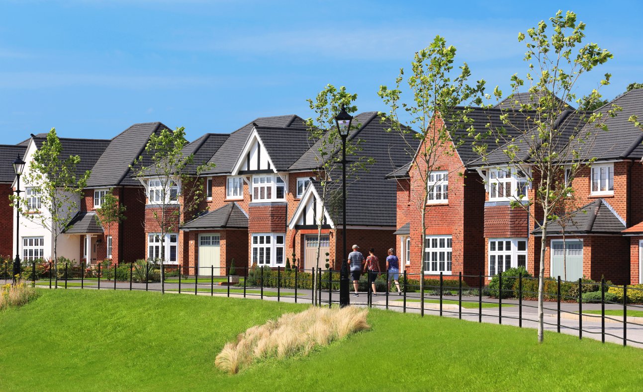
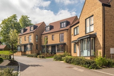
Example of how the new homes could look

As well as the new homes, our proposals include a range of amenities to support the wider Sustainable Community.
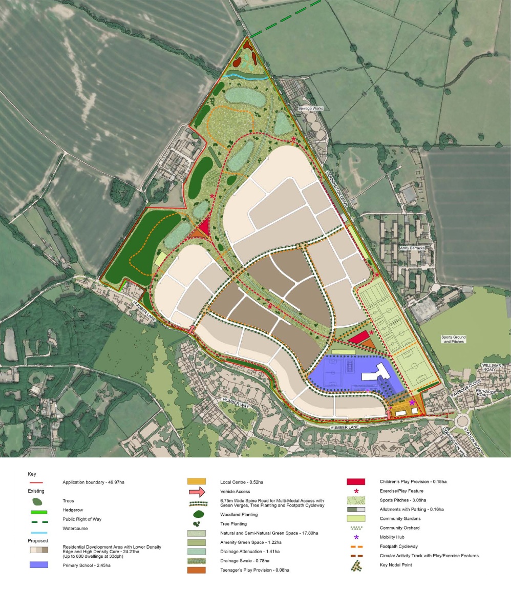
Local Centre
A Local Centre offering a range of community facilities and a Mobility Hub will be central to the development. A mix of uses will provide immediate day-to-day facilities for new and existing residents in the area.
Education
We will provide land for a Two-Form Entry Primary School with Nursery. These will be co-located with the Local Centre, ensuring appropriate new educational provision.
Green Infrastructure
The Masterplan is underpinned by a comprehensive green infrastructure network, including allotments, community orchards and landscaped walking and cycling routes.
Sports and Recreation
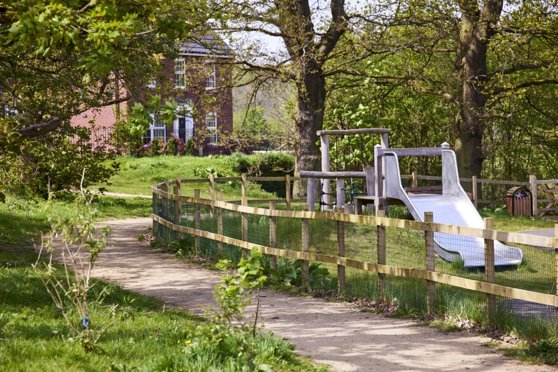
The development will provide social community space including sports pitches and children’s play spaces for all ages.
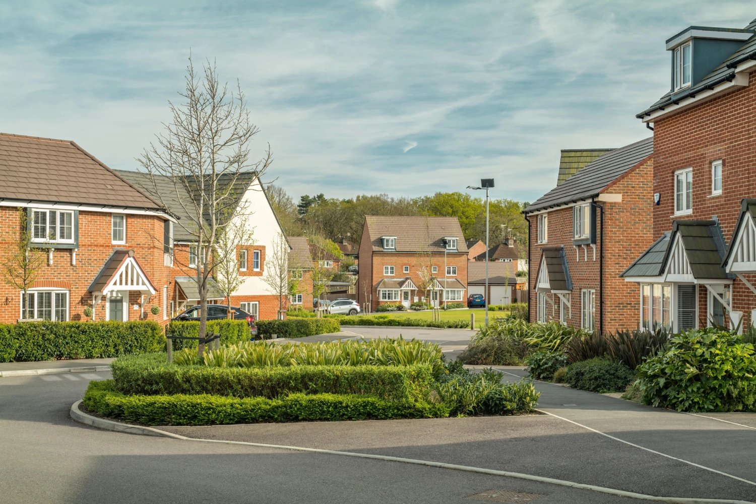
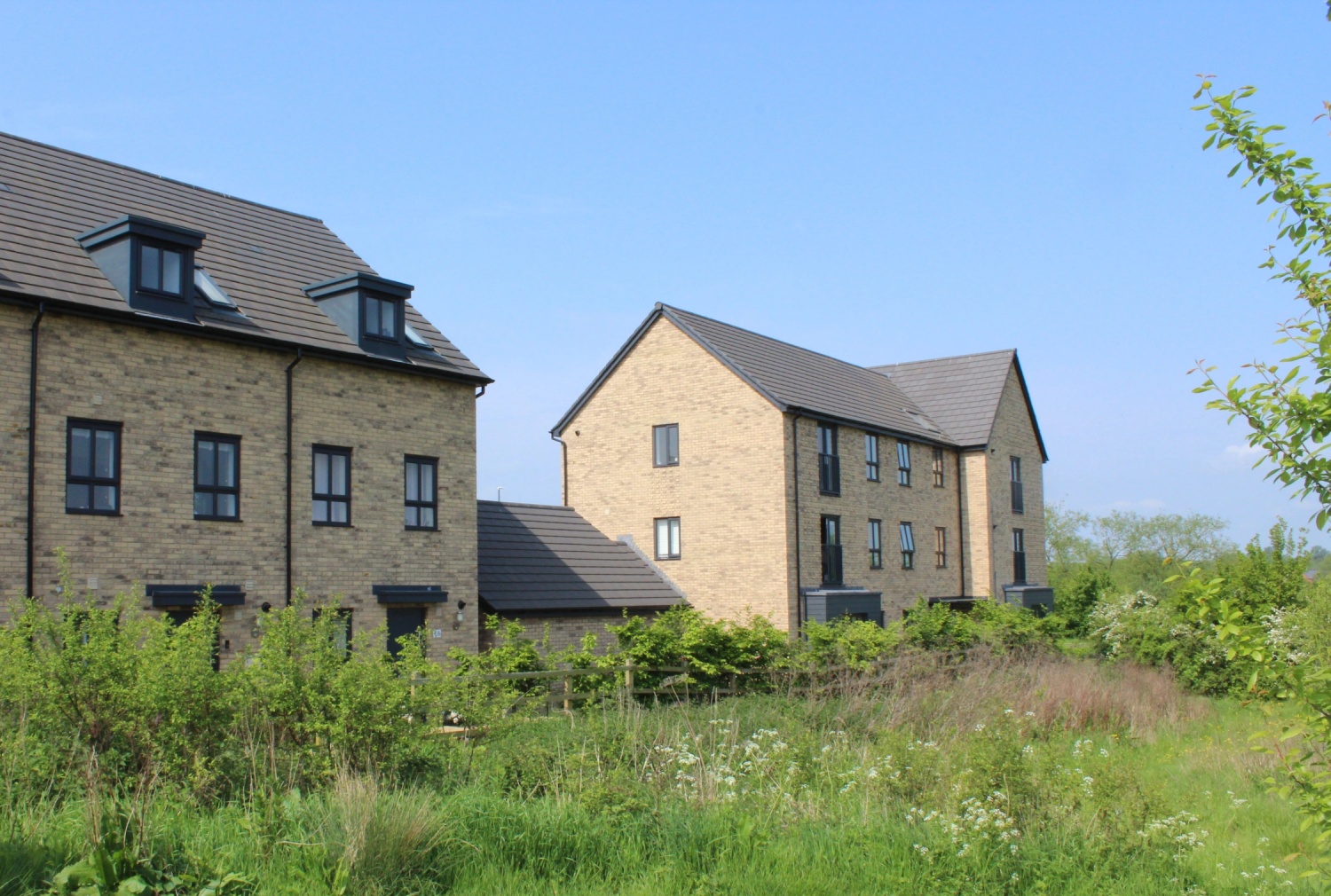
Examples of how the new homes could look
Illustrative Masterplan
Transport and Active Travel
Primary access to the site is proposed to be from Humber Lane via the two new access junctions shown on the Masterplan.
Improved pedestrian and cycle access along Humber Lane will also be provided to ensure that the site is well connected to key local Active Travel routes.
As part of the planning application, the impact of the proposals on the wider transport network will be assessed and any requirements for off-site improvements to support the development identified.
Active Travel will be prioritised within the Masterplan through the provision of a network of green corridors and cycleways, aligning with the Council’s aspirations for a Sustainable Community.
Key facilities, including the local centre, primary school and playing provision will be provided on-site, minimising the need for travel and enabling the use of walking and cycling.
Additionally, the proposed Mobility Hub within the Local Centre will act as a focal point for existing and future active and sustainable travel networks.
The Mobility Hub could include a range of sustainable transport facilities, potentially including public transport, cycle parking and EV charging.
The Masterplan and Transport Strategy for the site will therefore integrate with the Sustainable Community proposals.
This will enable wider networks of Active Travel routes to be developed and providing opportunities for public transport services that serve the wider area.
A future connection to the wider Sustainable Community across Donnington Drive is also identified within the Masterplan.
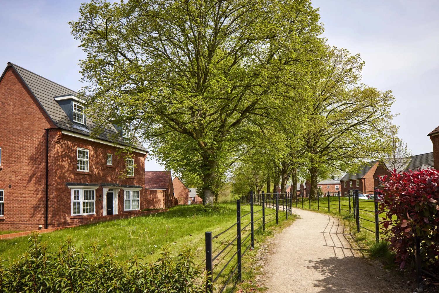
Examples of Active Travel routes
Other key considerations
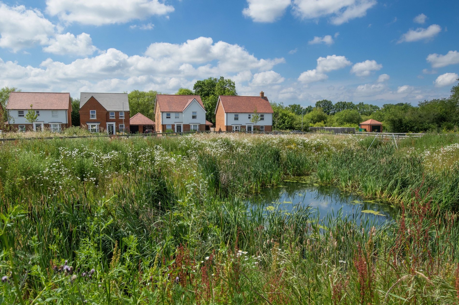
Landscape
Our proposal enhances the site’s existing network of landscape features.
The Masterplan shows a central linear natural open space and a landscape buffer with woodland planting to the north-west.
New areas of open space will provide access to green space for both new and existing residents.
Indicative landscaping features
Infrastructure
The development will generate significant investment into local infrastructure such as highways, healthcare and education. This will be informed by formal consultation on the submitted outline planning application carried out by Telford & Wrekin Council.
The investment will then be secured via a legal agreement between the developer and the Council and will ensure that key local services receive the investment they need to accommodate housing growth in Telford.
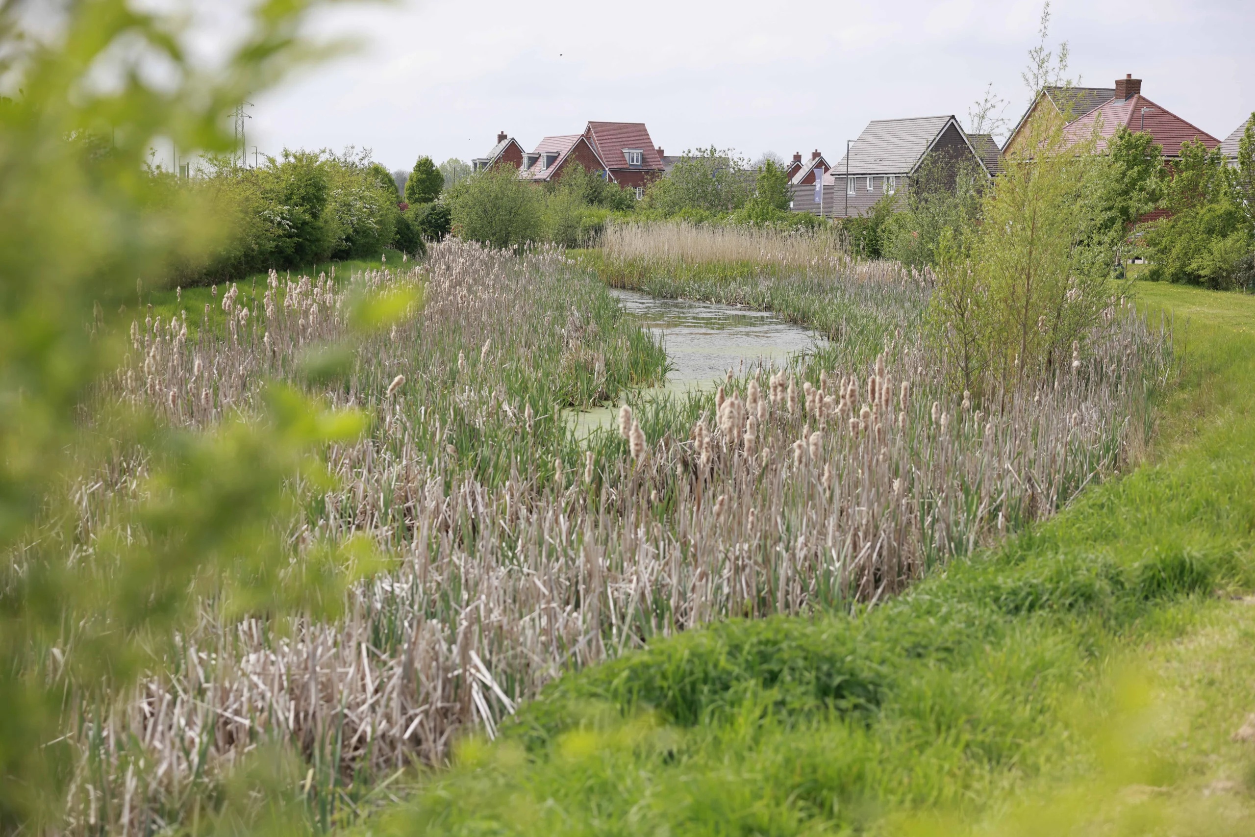
Indicative ecology features
Ecology
A range of ecology surveys have been completed to identify and mitigate for any impacts to species and habitats, and to inform the design and an Environmental Impact Assessment. This has included habitat surveys (UKHab, hedgerows, Biodiversity Net Gain) and surveys for bats, badgers, breeding and wintering birds, great crested newts, water vole, and otter.
Survey results have informed mitigation for various species, such as skylarks which were recorded in the field. Replacement habitat for skylark and other farmland birds will be provided within land nearby to ensure local farmland birds can continue to use the local area. Direct impacts to bird species will be avoided by nesting checks or sensitive timing of works to avoid the nesting season.
Impacts to bats and other species will be avoided by maximising retention of trees and hedgerows, a sensitive lighting plan, as well as providing better and more connected foraging habitats.
A dedicated biodiversity area has been included within the field to the north of the stream, which will offer a more secluded spot for nature to take shelter. Bat and bird boxes will also provide additional roosting and nesting opportunities within the retained trees. However, biodiversity has not been limited to this one area and has instead been considered for the design of the natural and semi-natural green space within the rest of the site too.
Lower value habitats to be lost such as the arable land and non-native conifers will be replaced by more diverse habitats within the natural and semi-natural green spaces. This includes native woodland, wetland, mixed scrub, and wildflower meadow.
These will act together as a wildlife corridor to connect the dots between habitats to the north, south, and west.
The proposed drainage attenuation basins and swale will also be designed with biodiversity in mind, such as including areas of wet meadow. The drainage swale, grassland, and trees associated with this will also provide connectivity through the site to the east, offering opportunities for pollinators such as bees and butterflies to access nearby residential gardens.
These habitats in combination will benefit animals including birds, bats, badger,hedgehog, and invertebrates and be accessible to enjoy by people via walking routes. Other areas will also provide benefits to both people and biodiversity, including a community orchard, community garden, and allotments.
Drainage
The proposed built development is located entirely within Flood Zone 1 (Low Probability).
EA Risk of Flooding from Surface Water mapping shows a surface water flow route through the centre of the site and areas of ponding in topographical depressions within the development.
An ordinary watercourse flows through the northern most point of the site but the flood risk associated with this watercourse is largely contained within the channel.
The site will be sequentially arranged so that built development will be placed outside of the areas shown at risk in the Flood Map for Planning and to avoid the surface water flow route.
The proposed layout, design and mitigation measures will ensure that occupiers and users of the development will remain safe from current and future flood risk events, without increasing flood risk elsewhere.
An appropriate Surface Water Drainage Strategy which complies with the latest local and national advice will be implemented on the site to attenuate the increase in surface water runoff caused by development.
Through the application of Sustainable Urban Drainage Systems (SuDS), the additional surface water will be stored within the site and subjected to multiple stages of treatment to guarantee that the water quality in the wider drainage network is protected. SuDS features will be above ground to enhance the aesthetic amenity of the development and provide valuable habitats for the local wildlife. The attenuation provided will be appropriately sized to include an allowance for climate change.
Consultation now closed
Thank you for taking the time to visit our consultation website.
We are passionate about local consultation and grateful for all the feedback we received on our plans.
All feedback has now been analysed and considered, and we have submitted a planning application to Telford & Wrekin Council.
You can find our application at the Telford & Wrekin Council planning portal (reference number TWC/2026/0495).
If you have any questions about the proposals, please do not hesitate to contact us. Our community affairs team can be reached via info@humberlaneconsultation.co.uk and
08000 356 480.
About Us
Gladman Developments Limited is the UK’s leading land promotion business. We are experienced in bringing forward high-quality and healthy communities that generate tangible benefits for new and existing residents.